Use Maps & Mapmaking in Your ELA Classroom
A MiddleWeb Blog
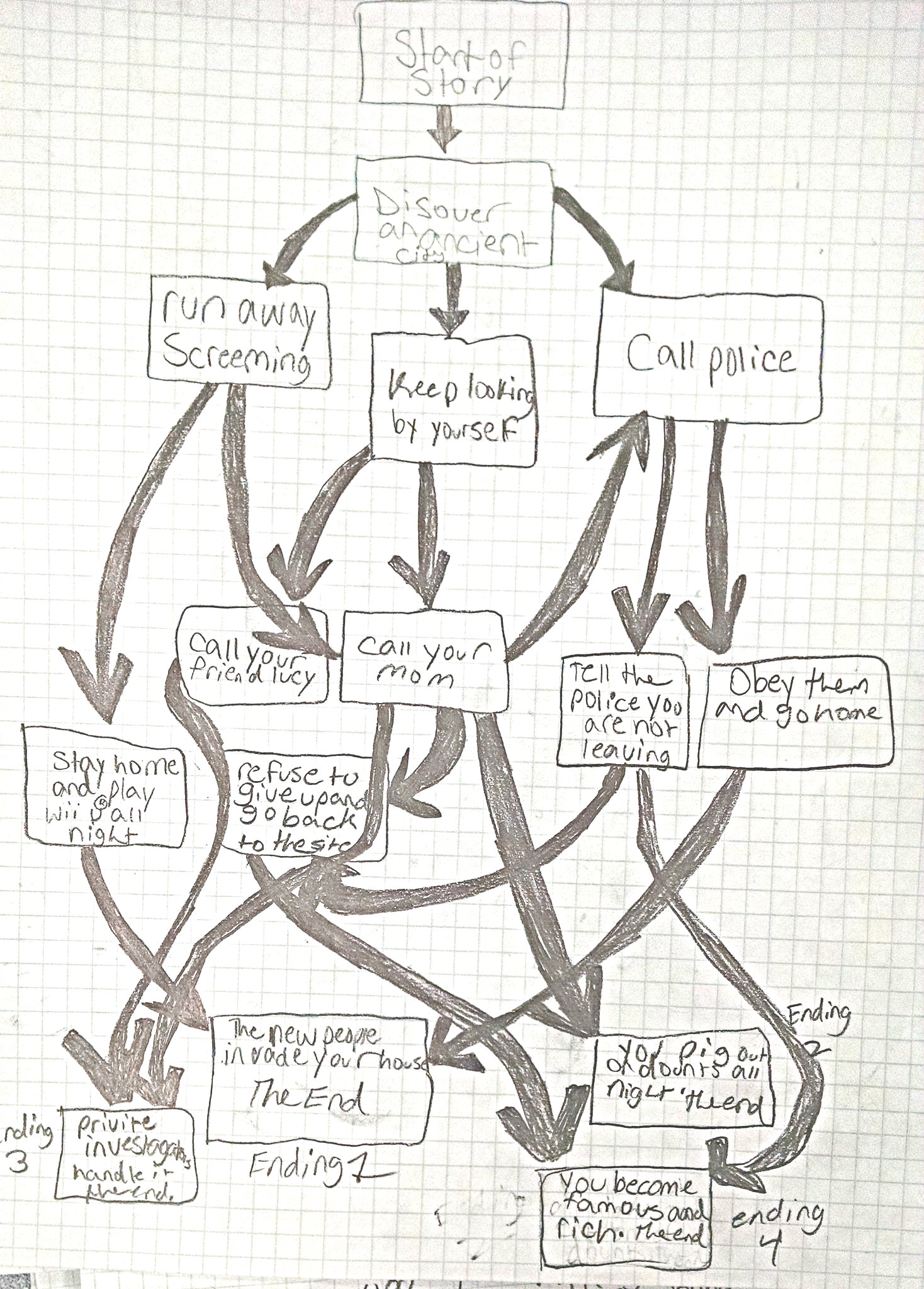
 One of the first writing prompts I do with my sixth graders each school year comes right on the heels of an early lesson around some basic literary concepts like character, setting and conflict
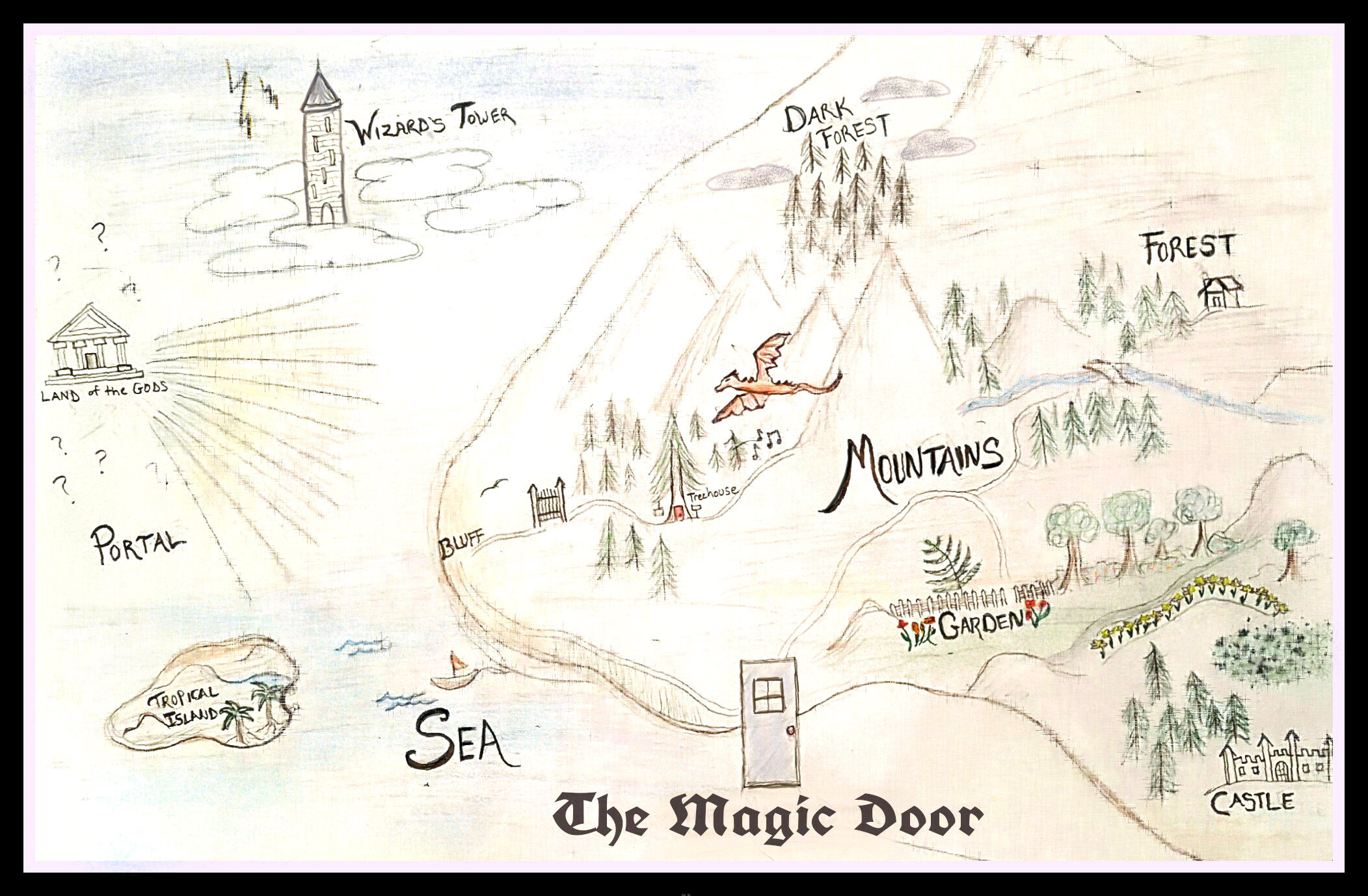
It begins when I hand them a map of an unknown place, and they have to use the map to tell a story.
I’ve used different maps over time, but often I pluck one from Internet sites that feature or write about fantasy games. They often have maps that are especially interesting to pre-teens.
This year, I discovered The Magic Door, which is an interactive game that can be played with Amazon’s voice-recognition program Alexa, and comes with a hand-drawn map that worked perfectly to spark my students’ imagination. (A few even went home after writing and played the game, reporting back the next day.)
I’m always intrigued by the way my student writers use the visual cues of someone else’s map to weave an adventure story. They’ll spend a long time studying the fine details of the map, trying to decipher the intent of the map creator. Then, they send their characters off into the unknown world, and the storytelling moves into high gear.
A month of wonderful maps
Maps themselves are such interesting artifacts, and I found myself thinking more deeply about how I use them, and extended possibilities, as the Connected Learning Massive Open Online Collaboration (CLMOOC) launched a Pop-Up Make Cycle for November on the theme of maps and map-making, in conjunction with a month-long hashtag festival of maps called #Mapvember on Twitter.
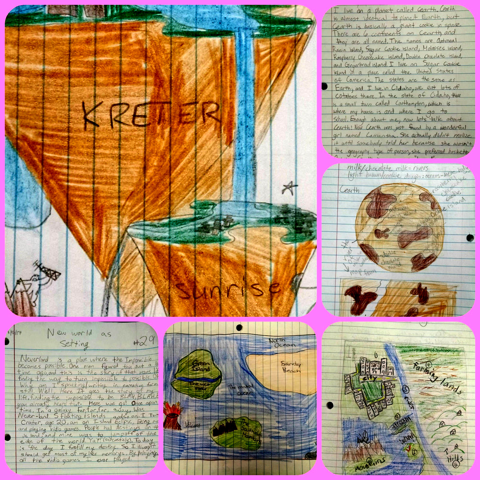
While the prompt I mentioned before, about using a map to inspire a story, is one approach, the opposite works, too. I’ve had students make maps after they have written a story, or done some sort of project, as a way to reflect on the kind of world building they have been doing. This has been very effective, for example, when we move into our Video Game Design Unit, where the map becomes part of the plan for developing, producing and publishing video game projects.
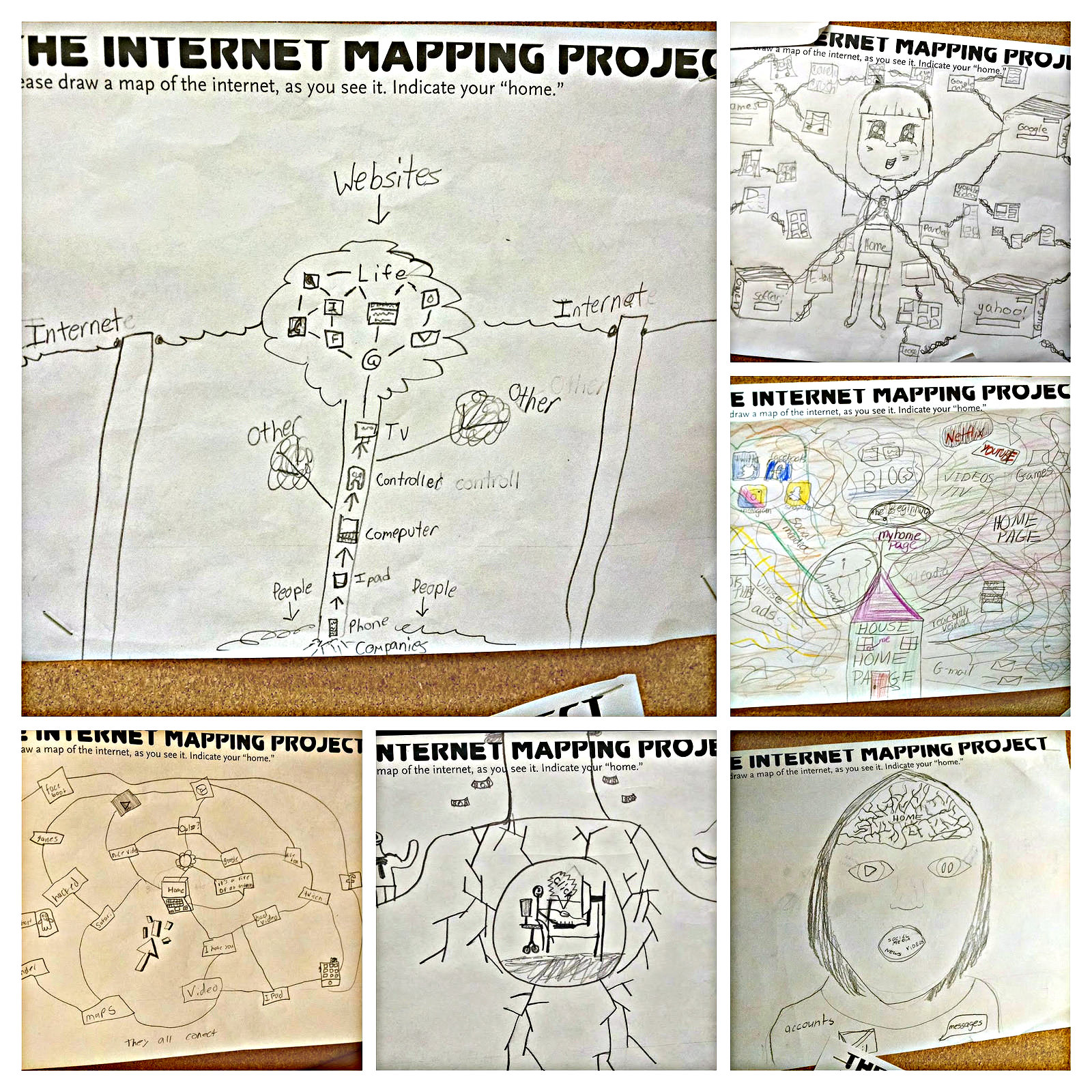
During a recent unit that I call Digital Life, where we talk about digital citizenship alongside privacy, advertising and other technology-related elements of their lives, I took a cue from futurist Kevin Kelly and used his Mapping the Internet project to have my students situate the relationship of themselves, and home, with the world of technology, social media and devices that swirl around their lives.
The reflective writing pieces that followed the mapping were quite insightful, as students wrote an “artist statement” about symbols and representations of technology on the Internet Map drawings.
Other ways to use maps in ELA classrooms
Here are some other ways I use maps during the school year in my English Language Arts class:
- During our expository writing unit, we use an architectural design of our K-6 school, and their task is to use clear language and elements of expository language (transitional phrases, etc.) to bring someone from the front doors to a secret party in the school. As students read aloud their writing, the rest of the class tries to guess where the party is, based on the writing.
- We use Google Maps, particularly in relation to a small but fascinating novel we read called Regarding the Fountain. In the book, a character sends postcards, telegrams and notes as she wanders the world in search of exotic materials for a new water fountain for a school. My readers track her wanderings in Google Maps, pinning her adventures and calculating distance.
- We map our neighborhoods to tell narrative stories. These maps are designed to spark memories of events and to bring the writer closer to the subject.
- When reading a novel that references the Underground Railroad, we map the insides of our own homes, adding secretive spaces, hidden tunnels and escape hatches, imagining our role as conductors on the Underground Railroad. Since our part of Massachusetts was used for the Underground Railroad, there are some students who live in old houses with indications of use by escaped slaves.
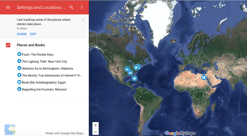
- I map our collection of classroom novels, by location in the world, through Google Maps. This allows an entry into discussion about setting, and the ways in which “place” shapes both a story and the characters within that story.
Cross-curricular connections
What maps can bring to the writing classroom is a visual connector point, and maps provide an easy connector to the learning going on in the Social Studies classroom, too. While our maps are rooted in imagination, as all maps are, the maps they see in other classrooms give students insights into the interpretations of the larger world. Where you pin yourself depends on where you are situated.
Some teaching tools to explore
Here are few mapping tools and resources that might be handy:




I always appreciate how clearly you explain your process, Kevin. And, how you get “outside the box” with additional ideas, examples, tools, etc. Thanks!