Bring Geography to Life by Tracking Hurricanes

“Why do we have to learn this? We have a GPS in our car!”
Each year, for the past decade or so, this has been the typical feedback I receive as we begin our geography unit. Until, that is, we engage in some real-world application of the skills I’ve promised to introduce.
I began teaching basic geography to fifth graders about 20 years ago – complete with the intimidating concepts of latitude and longitude. And for nearly that long, my social studies classes have been tracking hurricanes during the Atlantic hurricane season.
One summer, I found a large laminated hurricane chart while visiting the Outer Banks National Seashore gift shop in Kitty Hawk, North Carolina. I’m always on the lookout for inspiring posters and unique items for my classroom, and the erasable chart caught my eye. I purchased it, and that fall, my classes started tracking.
Because we live on the East Coast, hurricanes are not a foreign concept. Most of my Maryland students remember at least one tropical storm that has delivered a day off from school or flooded areas near their home. This is one case where it’s not hard to convince students that what I am teaching them is relevant to their lives.
Hurricane Trackers
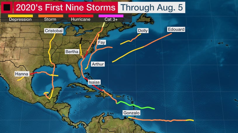
Atlantic hurricane season is conveniently timed from June-December so that we’re able to live-track much of the season. I provide each student with their own hurricane chart and each day, we visit the National Hurricane Center (www.nhc.noaa.gov) to view the geographic locations of hurricanes. I track along with the students on my large decades-old classroom chart located in the front of the room.
In the beginning, students are challenged to the point of frustration, and some are near tears. In this age of technology, I do not think many students have taken the time to complete such painstaking work before they undertake this exercise.
I am very particular about the tracking, and I walk the room to approve every single dot plotted. This takes a significant amount of time, but my theory is that the more detail-oriented I am, the more students will take the activity seriously. I also explain that scientists who track hurricanes must be very specific when they warn people in the hurricane’s path – we want to be deliberate and detailed just like the experts we hear on the Weather Channel or CNN.
I usually spend one entire class period tracking our first hurricane in full. I use a storm that has taken its full path in August or early September. After completing that “primer” hurricane, I take time at the beginning of class to introduce each new storm as it appears in the Atlantic.
Students soon begin entering class by asking, “What are we tracking today?” with great excitement, and they look on the board to see if I have longitude and latitude coordinates written.
Interdisciplinary Team-Up
In recent years, my colleague in the science department has redesigned his weather unit to coincide with my hurricane tracking. He introduces the scientific concepts of the development of hurricanes, including the characteristics, the Saffir-Simpson scale, and the stories behind various scientific advances in hurricane research.
We also team-teach when the schedule offers the opportunity, and I discuss geographic impacts as well as locations at risk along with the tracking.
Adapting to Remote Learning
As I move toward taking my lessons virtual this fall, I intend to use a variety of tools to continue our tracking tradition. Plotting storms together virtually might even be more effective as I can share my screen up close while I plot each day’s specific latitude and longitude. Or, I can have students share their screens with the class as they plot. I can also engage students in some of the apps and resources highlighted below.
Some Good Apps and Resources
Plenty of apps exist for tracking hurricanes, and I plan to use My Hurricane Tracker this fall as it shows the current latitude and longitude along with the forecast graphics. The National Hurricane Center has many resources from games like How to Aim a Hurricane and Create-A-Cane to online readings and hurricane webinars designed specifically for kids.
NASA, National Geographic, and Discovery Channel all have online readings and videos describing the development and destructive power of hurricanes.
Comet MetEd also has an online course titled Hurricane Strike! (see Special Interest, right column) – created for middle school students to learn about the development of hurricanes. The university supported Comet MetEd site is free, and teachers can register up to 50 student accounts to keep track of student progress on any of the courses. Hurricane Strike! has been updated in recent years but still relies on 2010 graphics and Adobe Flash for animation. Even so, the activities and readings keep the content engaging.
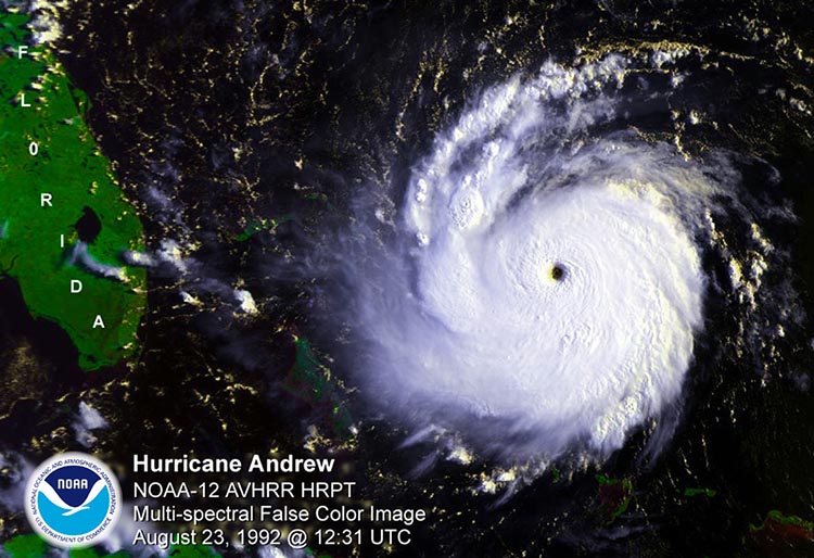
What makes these lessons timeless is their relevance. Students are excited to learn material that impacts their daily lives. We have tracked very powerful hurricanes, such as Maria and Dorian in 2019, which also spurred a sense of service in my students. Because they are aware of the destructive power of a hurricane, these students understand the needs of communities ravaged by these storms, and they are eager to help people impacted in any way they can.
By the end of our geography unit, my students’ understanding has expanded far beyond the basics of latitude and longitude coordinates. It’s one good example of how we can make “learning the basics” more relevant for the digitally immersed kids of Generation Z.
Jennifer Smith teaches Middle School Social Studies and serves as Fifth Grade Team Leader at the McDonogh School in Owings Mills, Maryland. She holds a B.A. from Smith College and an M.A.T. in History from the University of San Diego.















Excellent lesson planning ideas here and on NOAA’s site. My daughter, a recently separated USAF Instructor Pilot, is now a Lt. Commander, piloting for NOAA, as a ‘Hurricane Hunter’, tracking the storms that often wreak havoc around the map.